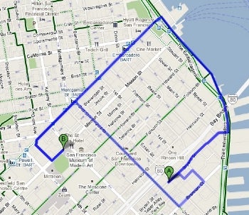
Google on Wednesday launched bicycle directions for Google Maps making it easier for cyclists to plan routes in 150 U.S. cities including Boston, Chicago, Los Angeles, New York, San Francisco, Portland and Washington, DC.
You can use Google Maps to find cycling-specific directions in urban areas, and by default Google Maps will plan your route to avoid steep hills whenever possible. The new maps feature can also be used as a map layer to get an overall sense of cycling accessibility in a particular city.There are two ways you can use Google Maps cycling information: for step-by-step directions or as a map layer to view all available cycling lanes and paths in your city. To get directions just click on the get directions link in Google Maps, enter your starting and ending points and then select 'bicycling' from the drop down menu. This will automatically start the cycling map layer and a variety of routes will appear in the left-hand column.
To compare the different routes, just hover your mouse over each route choice, and a light blue line will appear on the map showing you the difference between the selected route and the alternatives. If you don't like any of the route choices Google has made, you can drag the route indicator to change it.
If you just want to take a look at the cycling routes in your area select 'Bicycling' from the maps layer button labeled 'More...' in the top right corner of Google Maps.


No comments:
Post a Comment